Two days ago I was thrilled to find a blog which mentioned Scammerton, Pry and Erringden Grange farms, all farms that had been lived in at various times by one or more of my ancestors. https://landscapestory.co.uk/2020/04/27/april-spring-solace/Like me the writer records chatting to the current farmers. Not only that but the blog was really well written and was obviously the work of someone who is inspired and enthralled by the landscape of this area as much as I am. As I read further I found that to my amazement he visited the ruins of one farm, Dale, even having a picnic in what had once been the living room and when he got back home he went on Ancestry and found out who was living there in 1851: my ancestor, Thomas Butterworth! Now I’d had a few excursions onto this hillside, primarily to look at Winters, a tiny settlement where one of my ancestors had kept a beerhouse, and I knew from old maps where Dale was located, but it wasn’t clear how to get there. Although paths are marked on old maps I have no idea how steep they are, whether they are still in use, whether I need to climb stiles, or walls, or whether they consist of vertical stairways. )
So today off I went armed with current maps, old maps – and a picnic. When I boarded the bus to Blackshaw head the driver asked, “Do you live there? We’re not taking walkers, you know.” Well, no, I didn’t know that, and I’m still not sure that’s the official line, but I was one of two passengers on the bus so it was hardly crowded.
I headed off down Marsh Lane, knowing that led down to Winters and once in the little hamlet I found a diagonal track going steeply towards Dale – in fact, it was so steep and slippery with dry sandy soil that I did a few Heather specials – sitting down and sliding down the path on my rear end. The view across the valley was lovely and for the first time I notice the bulge of Erringden Moor between me and Stoodley Pike. It almost looked like a glacial drumlin. I knew from the map that this path was only about half a mile but its steepness made it seem much longer. I was too scared of losing my footing and dropping my phone to take photos of the path but I saw a tiny building on my left that I recognized from the Charlestown history site. It appears to be an outside loo with a stream running through it.
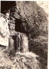
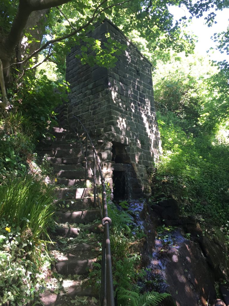
my photo of the cludgie
This building pictured above is referred to as the Cludgie (name for a toilet), but we are unsure what its original use was. The person on the photo was known as ‘owd Betsy who lived in the cottages.
And then suddenly another path crossed me hugging the contour of the hill and there was Dale – within an arm’s distance. The outside walls of the farm was about 3 ft high and the fireplace and some stone shelving was pretty intact. I welcomed a sit down on the wall after taking photos and was just contemplating setting up my phone for a distanced selfie when someone appeared on the path.
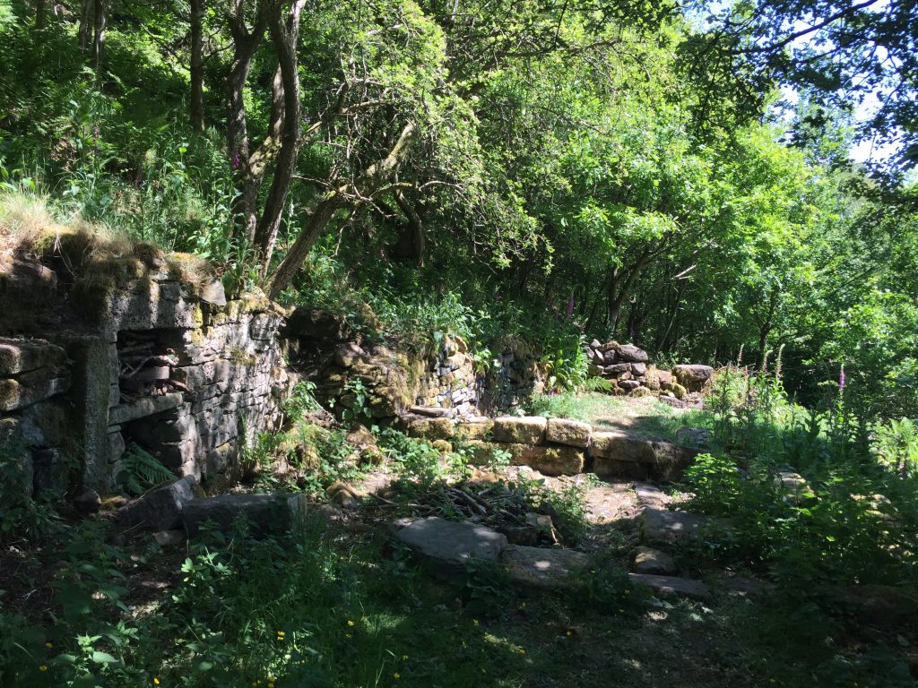
Dale 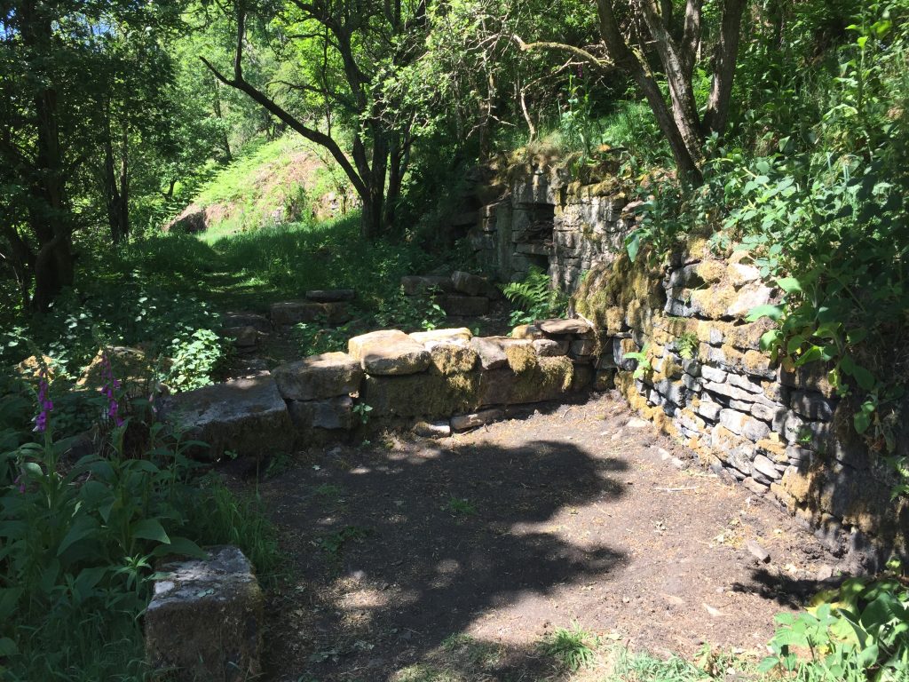
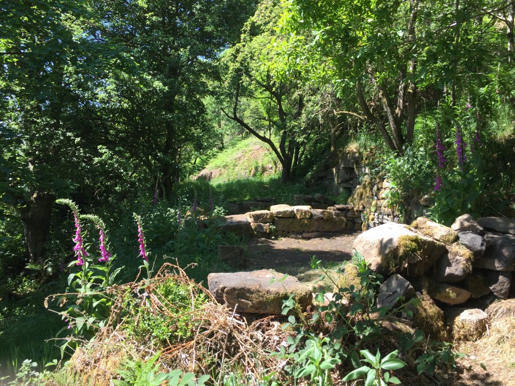
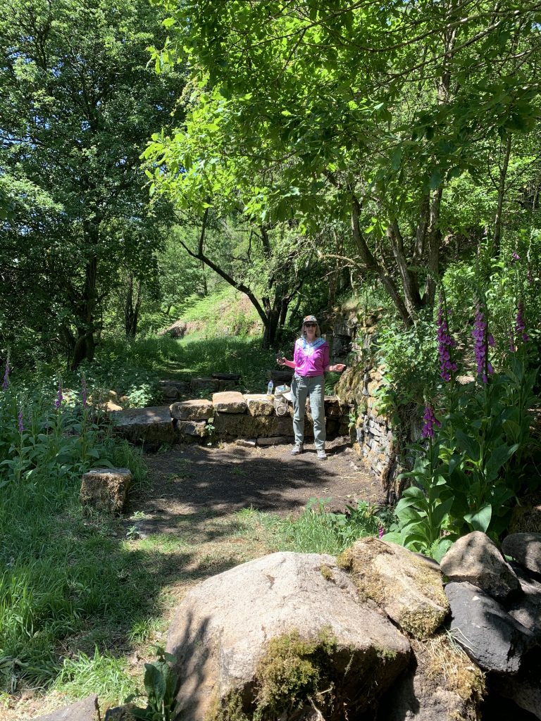
In the living room
I asked her which was the least steep road back down into the valley and she told me about a set of steps that go all the way down after crossing a little wooden bridge. She seemed in no hurry and so I told her of my reason for visiting the site, how I’d found a blog about it. “Oh, that’s probably Paul’s” she responded. She lives in the valley and had great knowledge about local history resources. She even took my photo and emailed it to me so I didn’t have to bother with the distanced selfie!
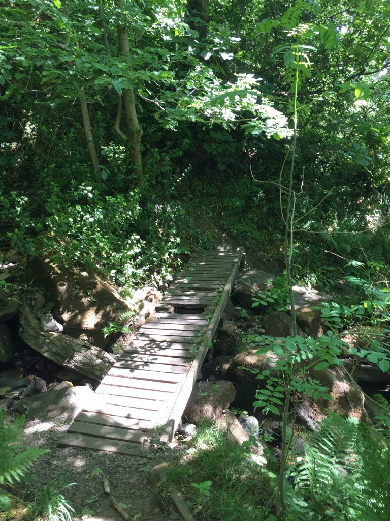
Finishing my picnic I followed her directions and crossed the wooden bridge over Dale Clough and the stairs awaited me.
At the top of the stairs was another ruined building, Higgin House and I stopped to take a couple of photos but it was impossible to step within its walls because it’s completely overgrown by large trees. Then I tackled the steps. From looking at contour maps it would seem that they ran vertically for almost 500 ft, but fortunately for much of the time there was either a wall, or an iron railing to steady myself.
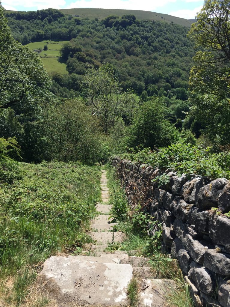
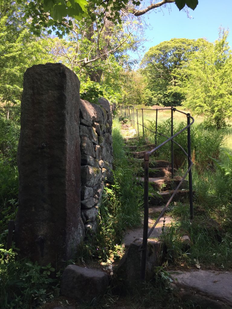
Looking back up
As I eventually reached level ground I found myself at Knott Hall which I’d ‘discovered’ a few weeks ago from another path. I followed Oakville Road, avoiding the main road and retracing my steps from 2 days ago. I knew that a row of terraced houses here once housed a non-alcoholic brewery in the cellar. It was owned by Billy Holt’s father. I’d reread Billy Holt’s autobiography during the lockdown. He had once lived at Hawdon Hall and the current owners of that place that given me the book as a birthday present last year. Small world! I’d wondered which house had been the brewery. At that moment a lady came from round the back of the cottages so I asked her if she knew the answer to my question. She pointed to a separate cottage and told me that the beer cellar had now been filled it. It was the house that I’d taken a photo of and sent to my daughters a little while ago because there’s a trampoline on the garage roof! http://www.hebdenbridgehistory.org.uk/charlestown/oakville.html#old
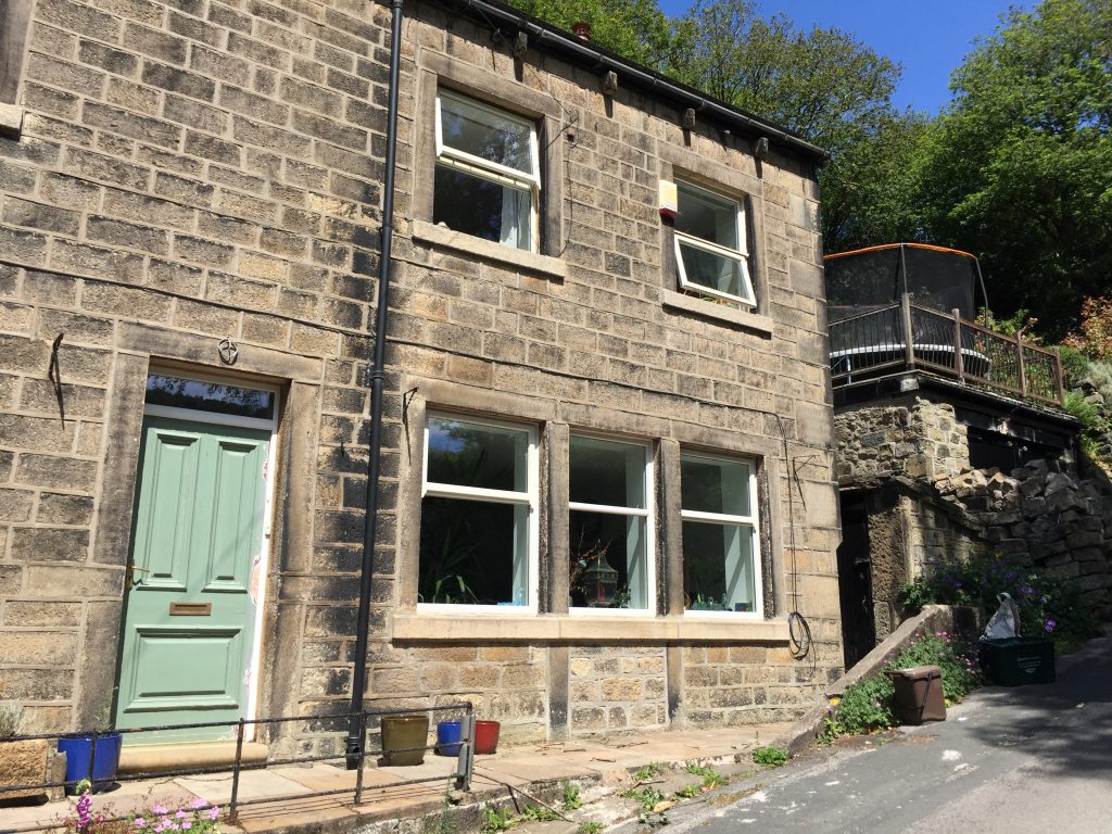
Of Thomas Butterworth
The first time I can locate Thomas with any degree of certainty is when he married Alice Jackson at Heptonstall church on October 20, 1811. They are both from Stansfield. There is a possibility that Thomas was baptized 6 June 1792 at Warley. I selected ‘that’ Thomas because his father was Ezra, and Thomas named one of his sons Ezra. In 1813 the first of their 7 or possibly 8 children was born, a daughter, Charlotte. 6 of the children were baptised at Myrtle Grove chapel on the same day, June 25, 1837. This meant that Charlotte was 24 when she was baptized, Richard 20, Sarah 17, Abrahma 15, Thomas 13 and Ezra 10. William was born in 1841 after a 10 year gap – strange. Last autumn when the leaves fell I noticed for the first time a cemetery close to the road to Todmorden and a few days later I overheard a conversation in which someone else was remarking on the fact that they’d never noticed the cemetery before. Apparently this is all that remains of Myrtle Grove chapel, Eastwood. From the Charlestown history site: By the early 1800s, with the coming of industrialisation, the population was moving from the tops into the valley bottom. Discussions about moving the chapel began in about 1805 and local gentry settled endowments for the new chapel to be built. The new chapel opened in the summer of 1807 was called Myrtle Grove and stood on the site that later became Eastwood Railway station. It had a capacity of 500 people.
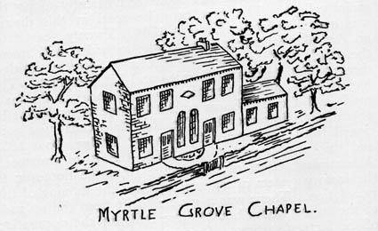
The congregation again declined from about 1820. In 1838 the railway petitioned to include the site of the Chapel and it was purchased by the railway company in the following year. A view of the Eastwood population at this time but there’s no source given:
“It must not be imagined from what has been written so far, that the inhabitants of Eastwood were all upright and honest citizens. there were evildoers in those days as there are now, and laws against theft or damage to property were much more drastic. Tradition has it that representatives of the village were sent as convicts to Australia. Stealing was by no means uncommon and occasionally cloth was taken from the handlooms. Hand weaving persisted for a long time after the coming of the power loom, and the weavers sometimes took precautions against theft by tying the warp ends to their feet before retiring for the night……The less reputable amongst the population indulged in such sports as cock fighting, rabbit coursing, clog fights or wrestling for wagers. The Non Conformists on the other hand, still strongly under the influence of puritan tradition, looked askance at such pleasures and regarded them as enticements of the Devil”. A new chapel was built and opened in 1840 so it would have been at the old chapel that Thomas and Alice had their children baptized.
(from the Charlestown history site).
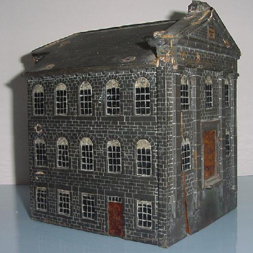
Another snippet which amused me was this: A few years ago one of the group was taking stuff to the tip at Eastwood and saw a small wooden model in a skip. She rescued it and later we discovered that it was of Eastwood Chapel. The three photos below show the level of detail on the model. Who made it, when or why, we don’t know.
Back to Thomas and his growing family. In 1841 the Butterworths were one of four families living at Higgin House, and Thomas is a worsted weaver. Yesterday, after I’d left the ruins of Dale I passed another ruin and took a photo of the place. This turns out to be Higgin House! It’s perched directly at the top of that steep flight of stairs. According to the Charlestown site it was once part of the Horsfall estate. (Leave that for a rainy day!) I wonder if the ‘sled road’ mentioned below was the steep stepped path I walked down yesterday:
The Rebuilding of
Underbank House
The building of the New House that
replaced the Great House at Underbank. John Lister Horsfall’s account book
records the pulling down and building of the present day Underbank house (short
of the Thomson’s modifications of course). The following is a summary.
First a sled road was made to allow stone to be pulled from Castle Hill to Underbank. Work began on March 10 and finished on March 20, 1834. This stone was used for “fronting” and for rebuilding some field walls. The road was then brought across the Higgin house and the Orchard field. This required 5 people and another to cut trees and cost 2 pounds, 18 shillings and 6 pence.
1851 find the Butterworth at Dale and by 1861 Thomas and Alice, both woolen weaver have moved to Underbank and their son, Ezra, has taken on the role of head of household, a plate layer for the railway line and a widower at the age of 33. However, there was less than 6 months between his first wife Sarah Horsfall. (Higgin House was part of the Horsfall’s estate!) dying and his marriage to Mary Gibson, daughter of the innkeeper of the Bull Inn, Hebden Bridge, who hanged himself in this slaughter house – see other postings in my blog). According to the handwritten account of Ezra’s life Sarah died in childbirth. “At some time he married, but, unfortunately his wife was a kleptomaniac, and was always taking home things she did not need and had not paid for. While this was a great worry to Ezra, it did not raise the problems at that time, in such a small community as Hebden Bridge then was, as it would today. Ezra just returned the goods to the under- standing shopkeepers and that was the end of the matter. She died early in married life on the birth of her first child. Ezra then met and married Mary Gibson. She was also born on a small farm called Winters at Eastwood on 5th September 1830. She was the fourth child and first daughter and always said she was unwanted as her mother disliked girls. However other daughters were born and they were accepted. Mary ran away from home when she was eight years old to her grandmother who kept a coaching inn in Bridge Lanes, The Bull. She spent a happy childhood there and had many tales to tell of people who frequented the inn. She was a good teller of tales and one which made a great impression on us was of the young woman who was poor and sold things from door to door. On being asked why she was doing this she said, “When I was young a well-to-do old man wanted to marry me but I loved a young man who was poor. We married but soon he died.” She added “But many’s the time I’ve rued that day for the old man’s brass ‘ud a bought a new pony.” It was this grandmother who when Mary was young, once pointed to the smoke of a house chimney and said solemnly “Mary, whenever there’s a neck there’s trouble.”
As a young girl she was apprenticed to Molly Day, a dressmaker. where she learned to sew most beautifully making voluminous dresses of the time entirely by hand. She and Ezra must always have known one another though it was not until June 1860 that they were married. Her brothers had warned her of Ezra’s drinking habits like many others associated with the railways in their early days. It was his great weakness.
They started married life at Weasel Hall, which is still there and can be seen on the hill- side from the main street in Hebden Bridge. (In fact that is the very view that I currently have as I sit at my desk in my living room). There on the 29th January Grace was born and two years later Gibson.”
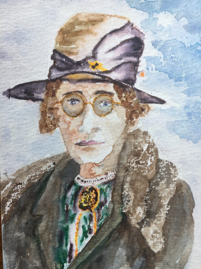
Thomas died at the grand old age of 75 in 1868 and he’s buried at St James’s in Hebden Bridge (where I sometime play the organ for services) but I’ve been unable to find him on the burial plot map.
P.S – Crazy fact from the Charlestown history site that I found while researching this page :
The Rochdale canal at Charlestown was crossed by an iron bridge which by 1934 was showing serious signs of wear. In 1939 track subsidence made it necessary for the bridge to be replaced. The job was given to Dorman Long who also built Sydney Harbour Bridge. What?????
Crazy coincidence: 2 days after writing about my trip to Dale I received a message about the website that took me to Dale – from the Heptonstall Historical Society of which I am a member:
I’m going to carry on sharing items of online interest that have come my way for the lockdown period. Let’s start with an absolutely gorgeous website of photographs and writing about our local landscape and its history put together by Paul Knights. Enjoy: https://landscapestory.co.uk/
28th June 2020 at 7:11 am
I have thoroughly enjoyed your blog, thank you for posting it. I have been researching an ancestor -Robert Dawson who was baptised on 21 Feb 1795 in Myrtle Grove Chapel, Eastwood. His father was John Dawson, weaver who lived on Swallowshaw, Stansfield from 1790 -1809 when he died. Robert’s siblings, also baptised in that little chapel were Abraham, Hannah & Susan. Robert joined 1st Regiment of Life Guards in 1812 at Milnbridge, near Hudderfield. In 1815 he went to the battle of Waterloo and returned to London where he married Mary Ann Ellis from Ireland. He remained in the Life Guards until 1838 when he retired to Lincolnshire but in 1851 he and Mary Ann and his five grown children migrated to Melbourne, Australia where he became a police officer at Port Fairy, Victoria. He died in 1877. Robert’s sister Hannah Dawson married William Helliwell who too had been in the 1st Life Guards but was discharged in 1809 and they only had one son, Joshua who went on to have seven children and their descendants have remained in the Todmorden district.