I moved back to England 3 years ago today!
Month: September 2020
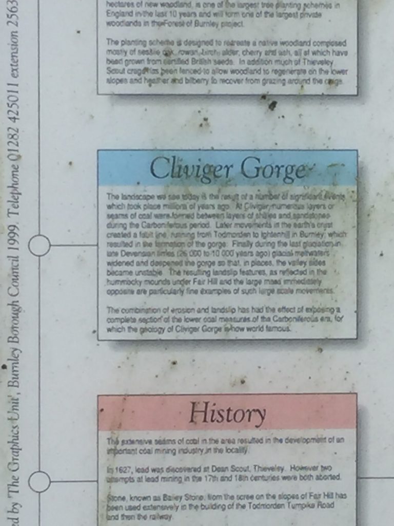
So I set off to walk a section of the A646 through Cliviger Gorge that I’d only driven along before, just a couple of days ago. by walking I see much more. I got the bus to Walk Mill and intended to walk back towards Todmorden, probably as far as Cornholme. It was overcast and for 5 minutes of my bus journey the rain came down quite heavily. I’d not been walking for more than a few minutes when I found a very helpful notice-board providing the answer to several questions that my recent visits to the area had generated.
First I wanted an explanation of the geology that caused this narrow, steep valley lined with hummocks, and, sure enough here was the reason: Cliviger gorge is a geological fault and the hummocks are rock slides caused by the slippage of unstable land.
Next stop was another visit to the church of St John the Divine where I’d failed to find the grave of Sir James York Scarlett.
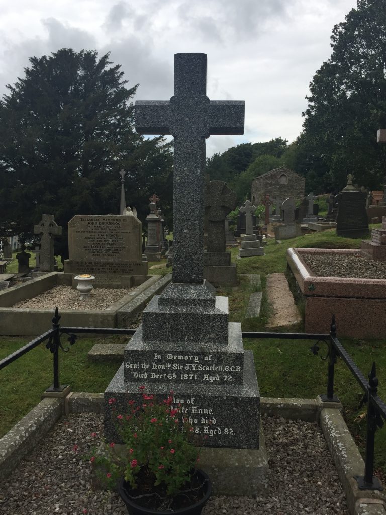
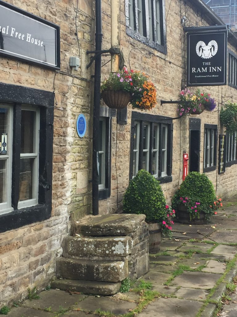
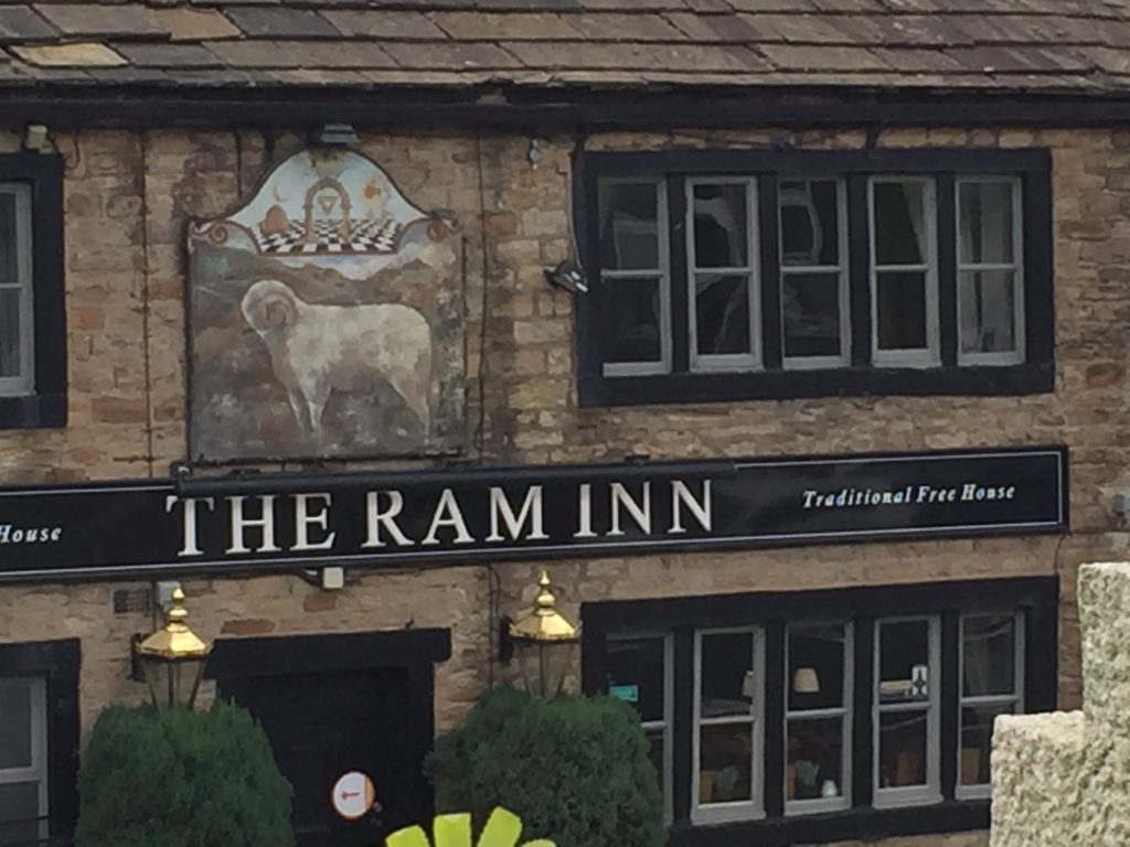
This time I found it straight away. Then on to The Ram Inn. Having parked the car in the car park at the rear of the building last week I hadn’t really noticed the painted sign of the Ram, nor the mounting block – which itself is Grade ll listed.

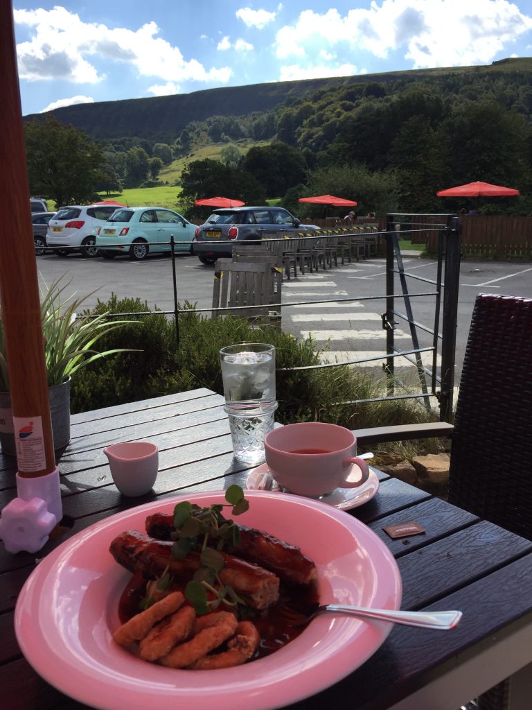
View from the beer garden 
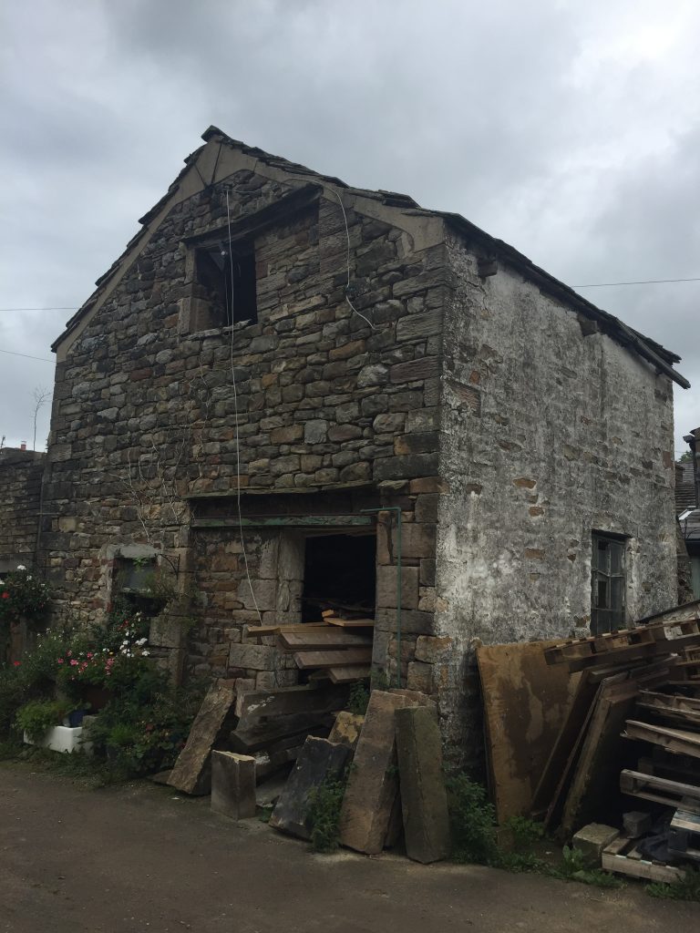
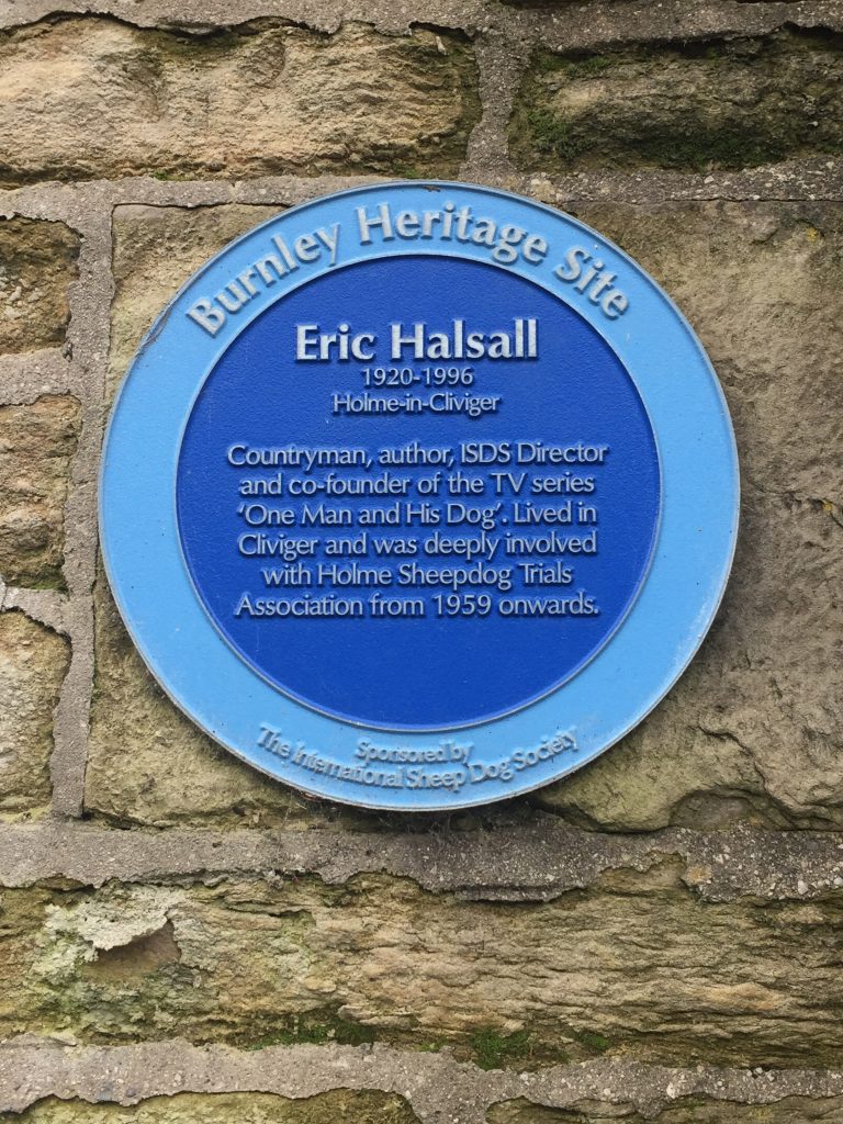
Next I came upon a blue plaque commemorating the founder of the TV series One Man and His Dog. I remember watching this program about the work that sheep dogs do in assisting the shepherds. We took our children to see the sheepdog trials on one of our visits to England. I’ll have to consult my journals as to when and where! As I looked down the valley I could actually see this happening right in front of me.
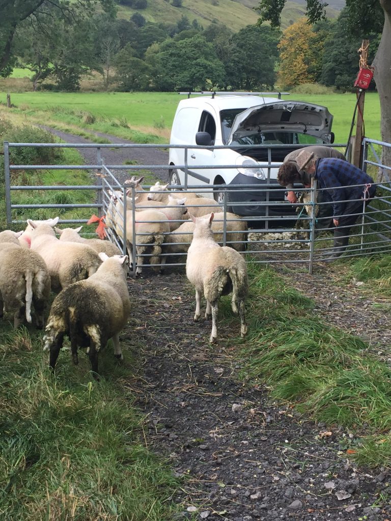
A few fields away I chatted to a couple of shepherds who were shearing the rear end of a group of a dozen sheep, cleaning their flanks and tails of poop. They explained that the poop attracts flies to that area of their body, the flies lay eggs and soon the sheep’s wool is full of maggots. Guess I learn something every day!
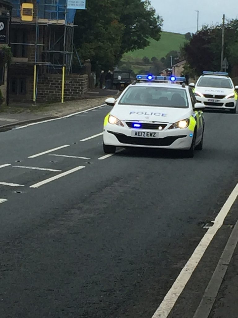
Just at that moment an air ambulance flew above the valley, turned around and flew along the valley again. A couple of minutes later 4 police cars came along at great speed, sirens blaring, heading in the direction I was walking. All traffic came to a standstill and within a few minutes many car were turning round, their way blocked by a police car. I could see that even a couple of bicycles were being turned around. Of course I was the only one on foot and I approached the policeman with some concern. As I anticipated I was not allowed to go any further. He was most helpful as to what my options were – climb 600 ft and hike 8 miles along Long Causeway? – no! Call someone to come and pick me up by car? – I don’t know anyone available. Call a taxi? Obviously all the buses had been stopped. “How long is the road likely to be blocked for?” I asked. “Could be several hours. This is a major incident.” I could see the air ambulance had landed in a field close by. As he turned around car after car I decided the only thing for it was to hitch a lift with someone heading for Todmorden and after a couple of tries a couple offered me a ride – via Bacup. It probably took 20-25 minutes to get back into Todmorden and I was very grateful for the ride.
Back in Tod I called in at the market for some black embroidery floss. I would work on my textile project. Walking through Cliviger Gorge will have to wait for another day.
So, inspired by another video from Nick, I set off to find St John the Divine church in Holme Chapel, situated in the Cliviger Gorge: https://www.youtube.com/watch?v=m4Zln5clYTg&list=WL&index=54&t=1968s
This was to be my third trip exploring the valley and on a previous bus ride I’d noticed a pub at Holme Chapel with tables set out at the rear giving great views of the opposite side of the valley, so I planned to have lunch there with Jane and then we’d see what there was to see at the chapel itself. There’s no actual village of Cliviger – it’s the name given to the collection of 5 villages that constitute the parish of Cliviger.
In 1588, the queen Elizabeth I gave to her principal surgeon, Robert Balthrope, a coal mine in Cliviger. This was later transferred toJohn Towneley of Towneley Hall. TLimestone was mined at Shedden Clough in the 17th century and lead mining was attempted at Thieveley in the early 17th and mid 18th centuries. Also near Pot Oven Farm, there are the remains of a blast furnace constructed around 1700 for the Spencer partnership. I seem to remember learning about blast furnaces in science lessons at school! Although it had become a pottery by 1760, it is thought to be the first blast furnace built in Lancashire. During the mid-18th century, Cliviger produced worsted woollen pieces for the neighbouring town of Burnley. Open cast coal mining took place in the 1940s and 50s above Thieveley Scout and on Deerplay Moor.
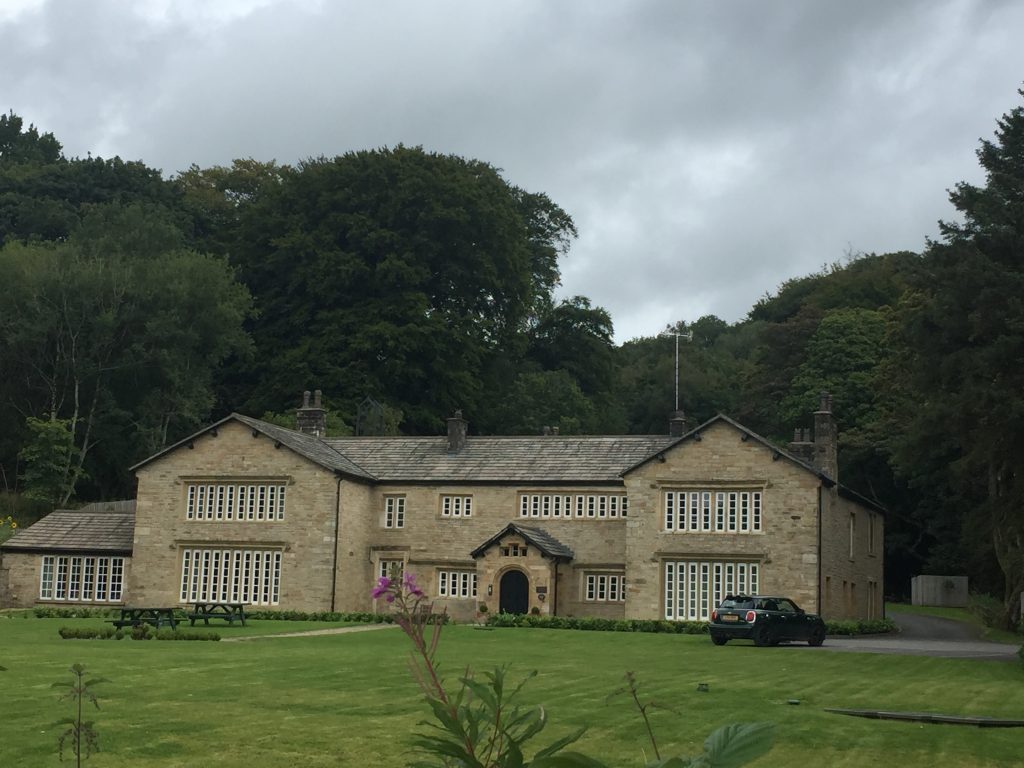
I’d read that close to the pub and chapel was Holme House which had once been the home of a man who had written a famous history of Whalley and he’d enlisted the artistic talents of one J. W. Turner to illustrate it. Wow! Then I read that his old home had recently burned down, or a least a large wing of it had been destroyed. When I mentioned the fire Jane immediately knew which house it was and we turned off onto a short drive and there was the old manor house, now fully functional, and converted into flats. It’s still an imposing building but looks rather new. Holme Hall dates back to 1340 when Richard de Whitacre arrived in Cliviger from High Whiteacre (Padiham). In 1431, The Holme, then a manor house of 40 rooms, was referenced in connection with Thomas Whitaker. The process of converting the original wooden structure into stone began in 1603 and was completed 1717 with west wing. The Whitakers built an extension to the rear in 1854. The land once belonged to the Tattersall family and housed a chapel which lent its name to the neighbouring village of Holme Chapel.
And then I discovered something so unexpected it stopped me in my tracks. Rev Alexander Whitaker, 1576-1617 sailed with Sir John Dale in 1611 to the colony of Virginia in Chesapeake Bay, becoming known as The Apostle of Virgina. My goodness. From here to the U.S (or at least what would eventually become the U. S.) in 1611!!! 2 years later Pocahontas, the daughter of the native American chief, was captured and placed under Whitaker’s care where he was taught English and the Christian religion. She was given the honorary title ‘Princess’ and it is generally believed that this minister from Holme House officiated at her baptism and eventual marriage to John Rolfe, the founder of the Virginian Tobacco Industry. Little did I think that there would be any connection to the U.S on my visit to this little village today. My daughters learned the story of Pocahontas in their American history lessons, but I certainly had never heard of her until then. Whitaker drowned while crossing the James River in 1616.
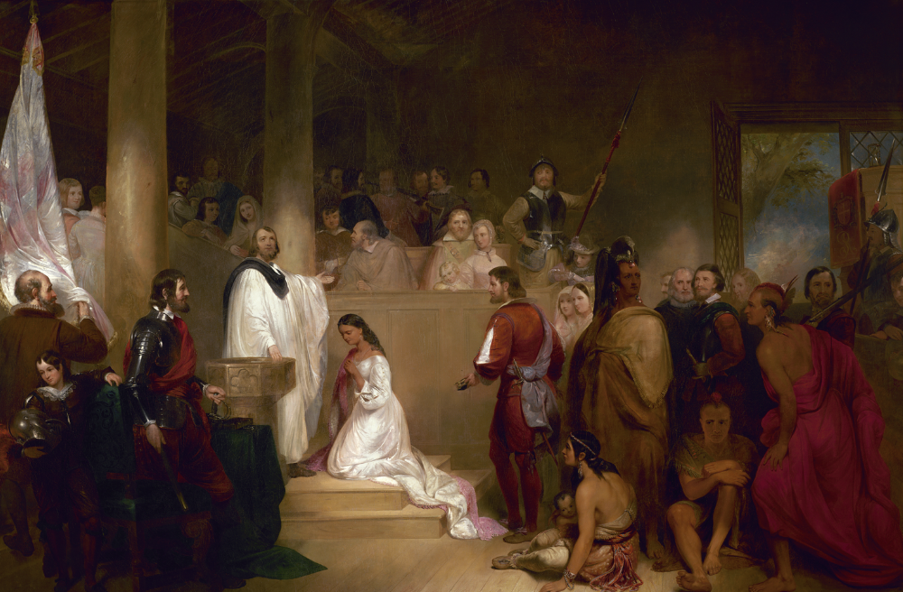
Baptism of Pocahontas by John Gadsby Chapman, 1840 with Whitaker in white 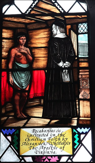
Stained glass but I don’t know which church this is.
Then it was over the road for lunch in the lovely gardens of the ancient Ram Inn. Like Holme House it’s a Grade II building. It has a lovely stone roof and mullioned windows and a mounting block for getting on your horse.
We enjoyed our lunch, going with the traditional sausage and mash – excellent.
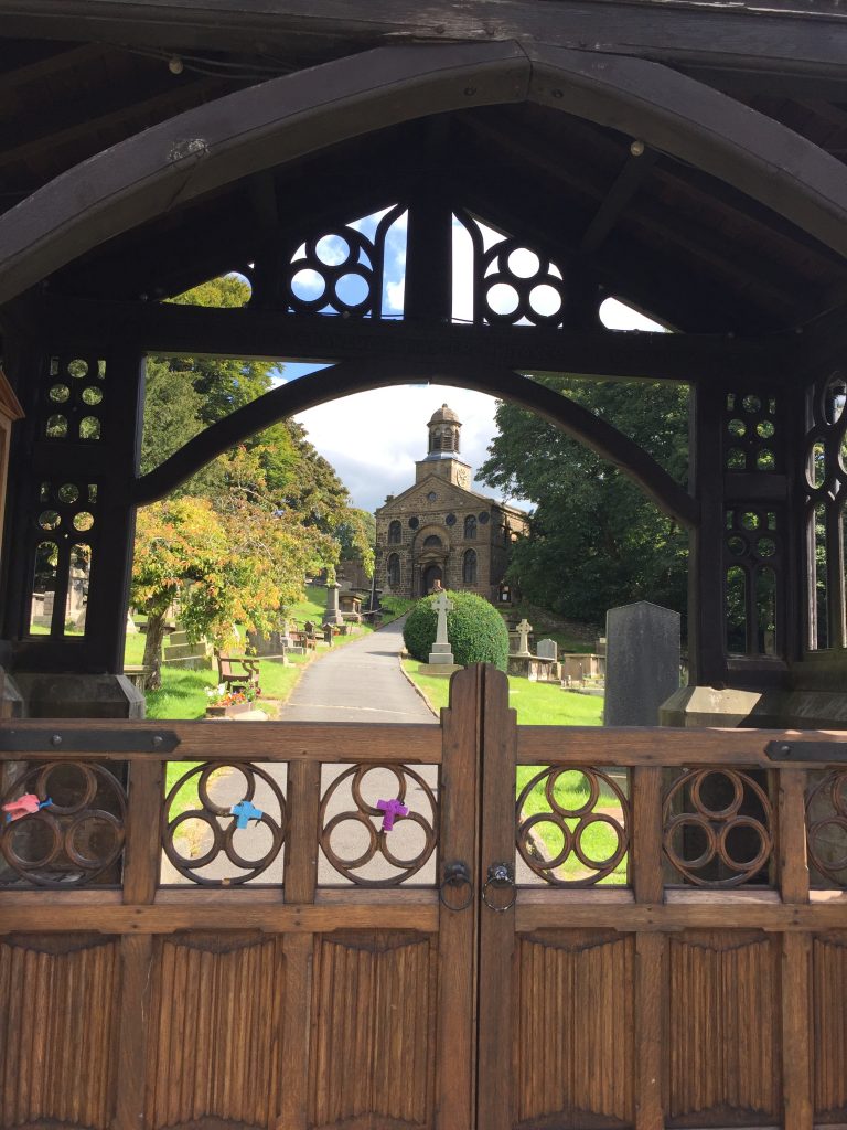
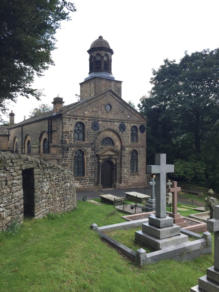
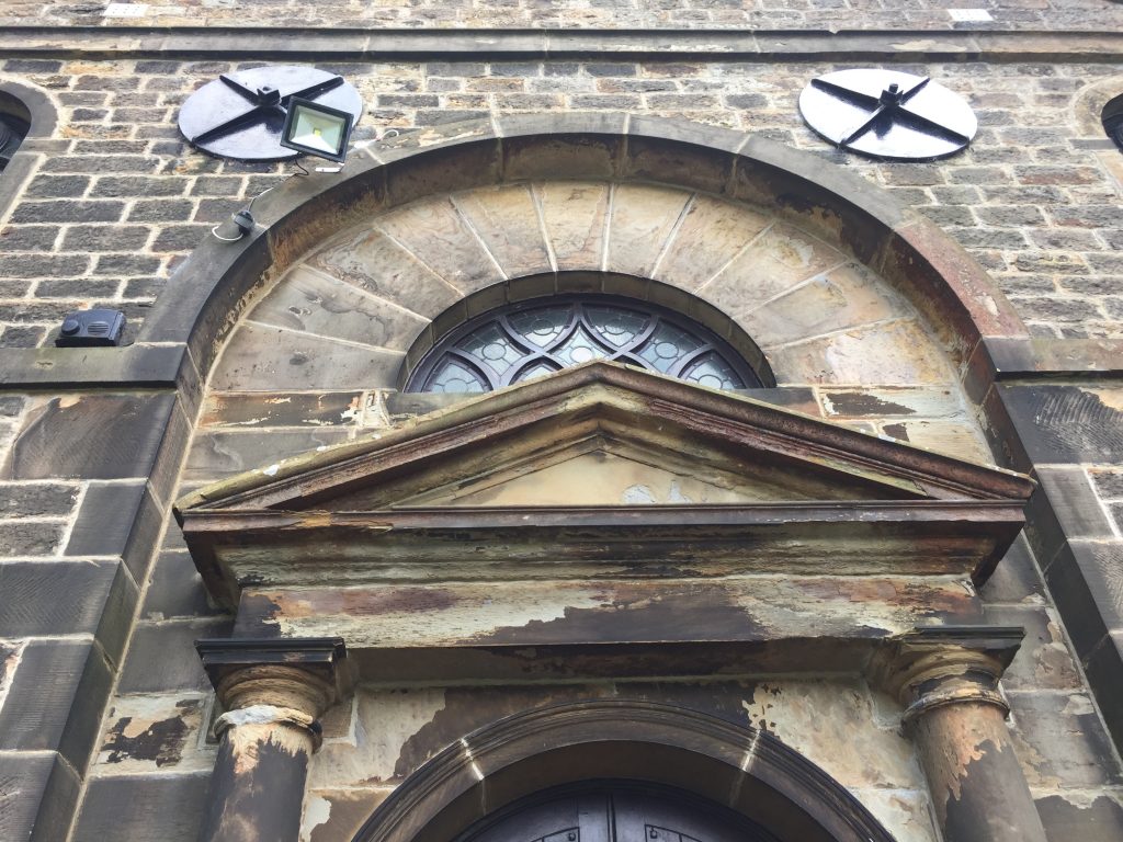
Then it was merely a few steps across the main road leading to Burnley and we were at the lychgate leading to the church St John the Divine. Besides the church being unusual for a small rural parish being constructed in the Classical style I had wanted to take photos of it for a specific reason. I’m currently taking an online art class in architectural drawing and I thought that church would give me a good subject to work from. Yet another Grade ll listed building it was built between 1788 and 1794, replacing a small chapel, and is in simple Classical style.
Above the west front is a bell turret with an octagonal cupola, and inside the church are carved oak stalls, moved from a demolished church, which include a poppyhead and misericords. All this talk of Grade II listed building reminds me of the house we lived in in Bedfordshire, Wet Manor in the village of Milton Ernest which was a Grade II building, built just before 1600. Not surprisingly the church wasn’t open though it is still a functioning church with regular services. But I was disappointed not to be able to walk around the exterior of the church – it was fenced off, so I contented myself by wandering round the very well maintained graveyard. I was on the lookout for the grave of Captain Scarlett, who led the Charge of the Heavy Brigade during the Crimean War. When I first heard this mentioned by Nick in his video I though it was a joke . . . I mean, everyone’s heard of the Charge of the Light Brigade, right? According to the Household Cavalry Museum’s website: In 1854, the Royals were the first British regiment to deploy abroad as part of a joint Anglo-French army that journeyed to the Crimea in support of the Ottoman Empire in its war with the Russians. The Royals achieved military success in a display of what cavalry were capable of at the Battle of Balaclava where, in the engagement known as the ‘Charge of the Heavy Brigade’, a force of 800 British cavalry, with the Royals at their heart, routed a force of 3000 Russian light horseman in an engagement that lasted barely eight minutes. Unfortunately, this triumph has been somewhat overshadowed by the disaster at the same battle which was the Charge of the Light Brigade. So how on earth did this highly decorated military gentleman come to be buried in this tiny village in Lancashire? Son of a Baron he’d been educated at Eton and Trinity College, Cambridge and in 1835 he had married Charlotte Ann Hargreaves a coal heiress from Burnley and from then on he made Burnley his home. After his military career he became a conservative member of parliament and on retirement he stood again as a member for Burnley but was narrowly defeated. When he died in 1871 and estimated 60,000 people lined the streets of Burnley for his funeral procession. There was a General Scarlett pub in Burnley named after him and in 2016 it became the Scarlett Tea Rooms. As I wandered around the tiny village it was hard to match this quiet enclave with the vigour and bravery shown by Capt. Scarlett.
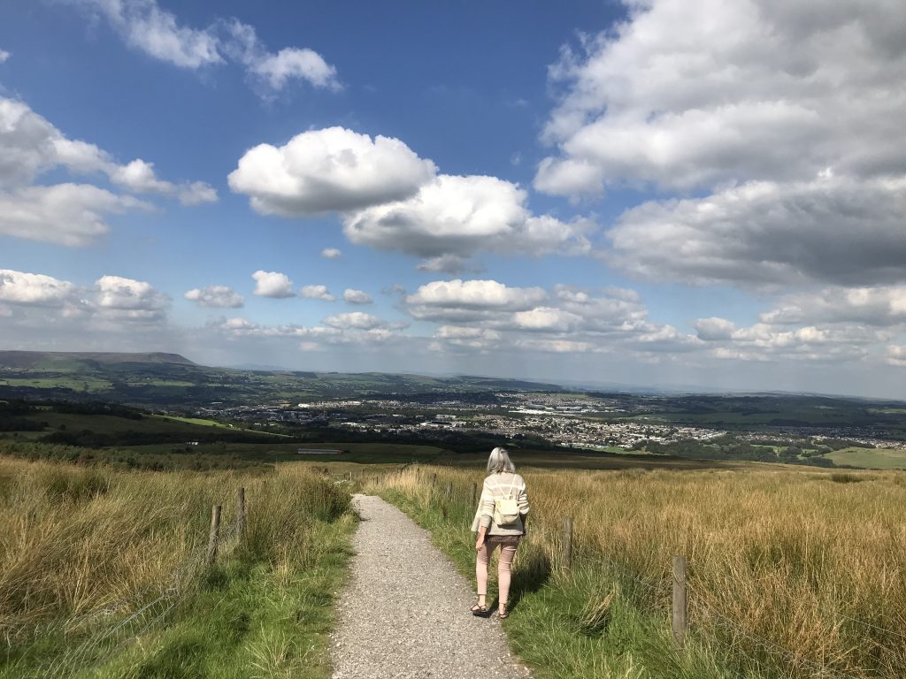
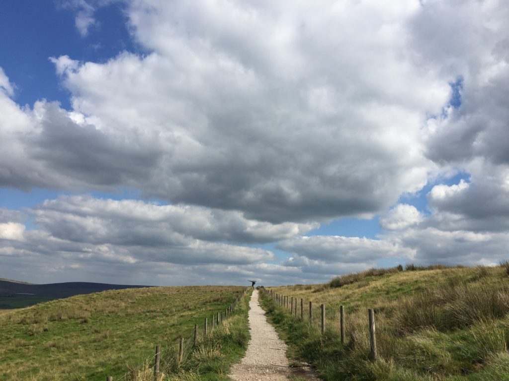
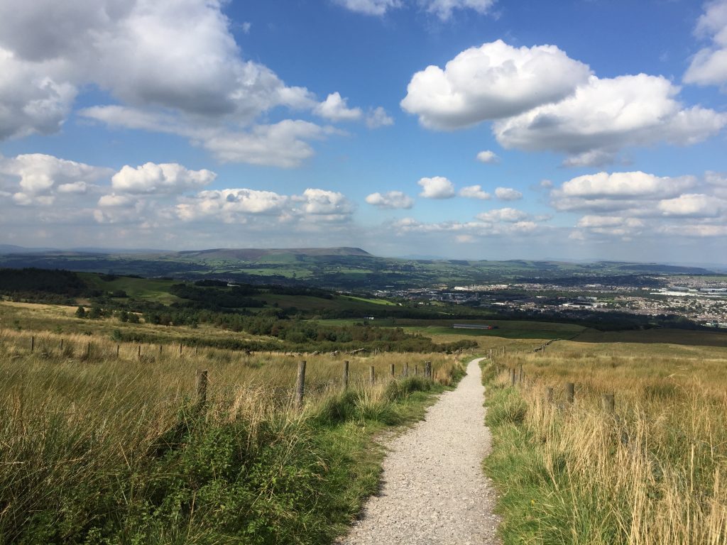
Our final stop was at the Singing Ringing Tree, a panopticon overlooking the Cliviger Gorge, and with a gentle breeze blowing it sang to us. The sky had cleared of its earlier clouds and so we could see way into the distance. I think I could see Ingleborough. A diagram of the points of interest would have been very useful!
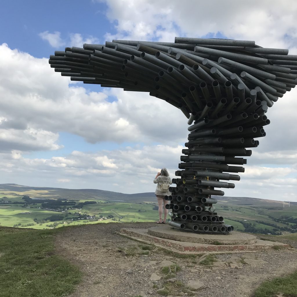
Looking forward to exploring more of the valley soon.
It was September 2020. Having watched a YouTube video about the ruined Shore Baptist chapel I was eager to visit the site. I couldn’t find it on a current map but I kew it was up a very steep road out of Cornholme so with a friend’s willing assistance we set off by car. We took a couple of wrong turns but that was ok because our view was fantastic – almost on a par with the drone footage of the Cliviger Gorge I’d watched online the previous evening. There is a small village of Shore clinging to the hillside and outside one of the houses I saw a resident working in the garden and she gave me directions to the site of the church – along Pudding Lane (!) and Shore Green Lane, and we were there. From the roadside it’s nothing special so without having seen the video I wouldn’t have looked twice at it – but I knew what lurked behind the unimposing wall.
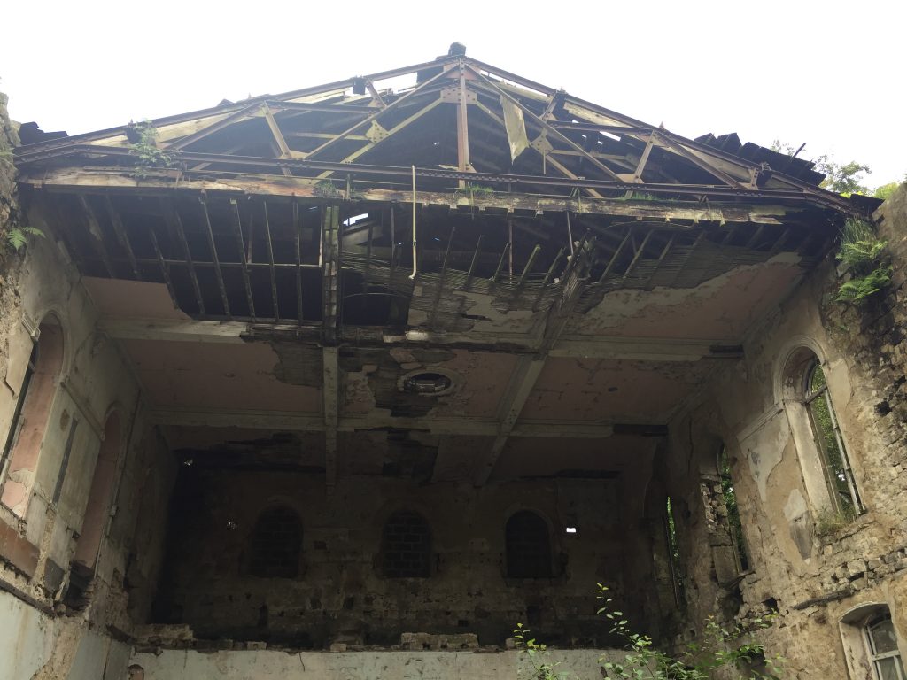
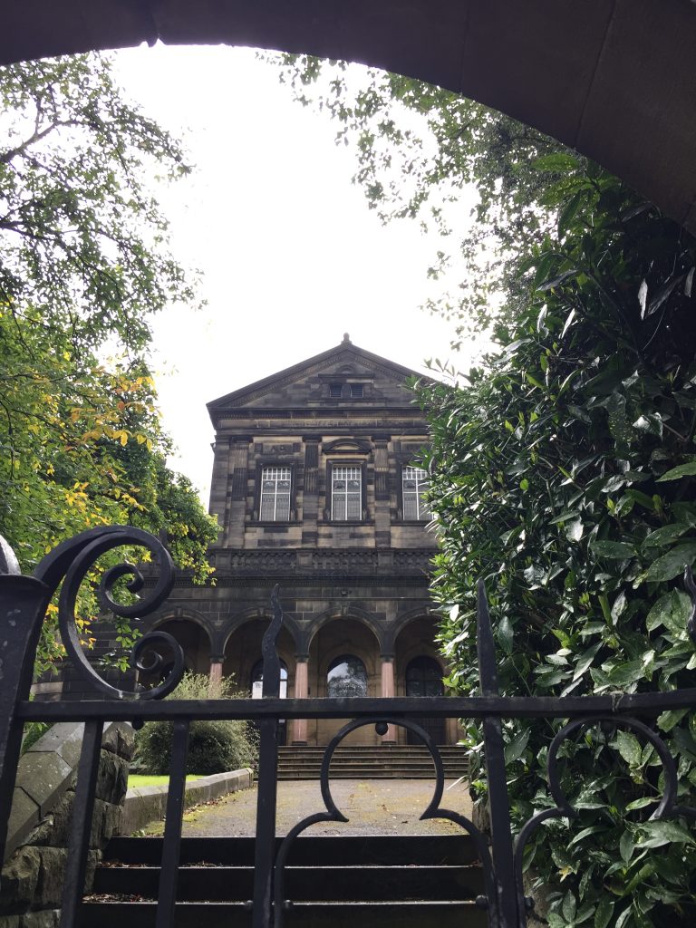
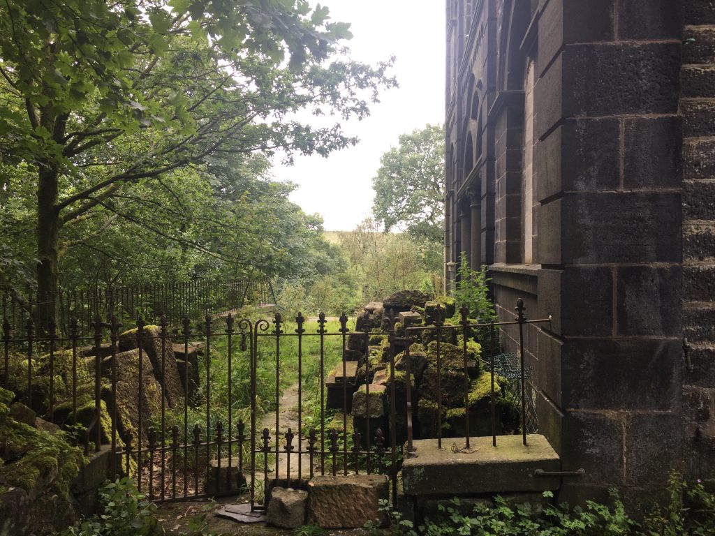
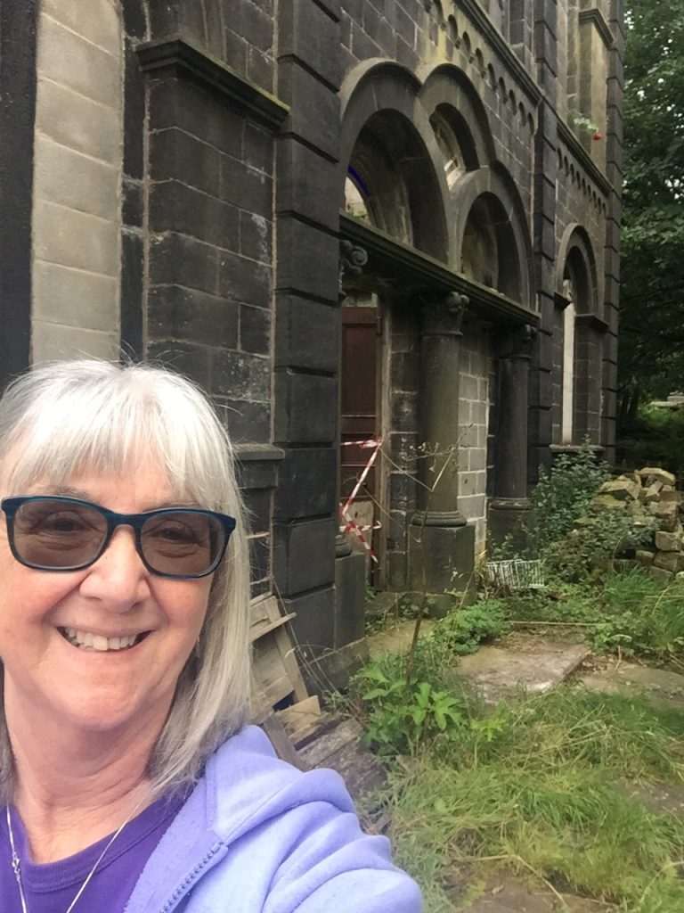
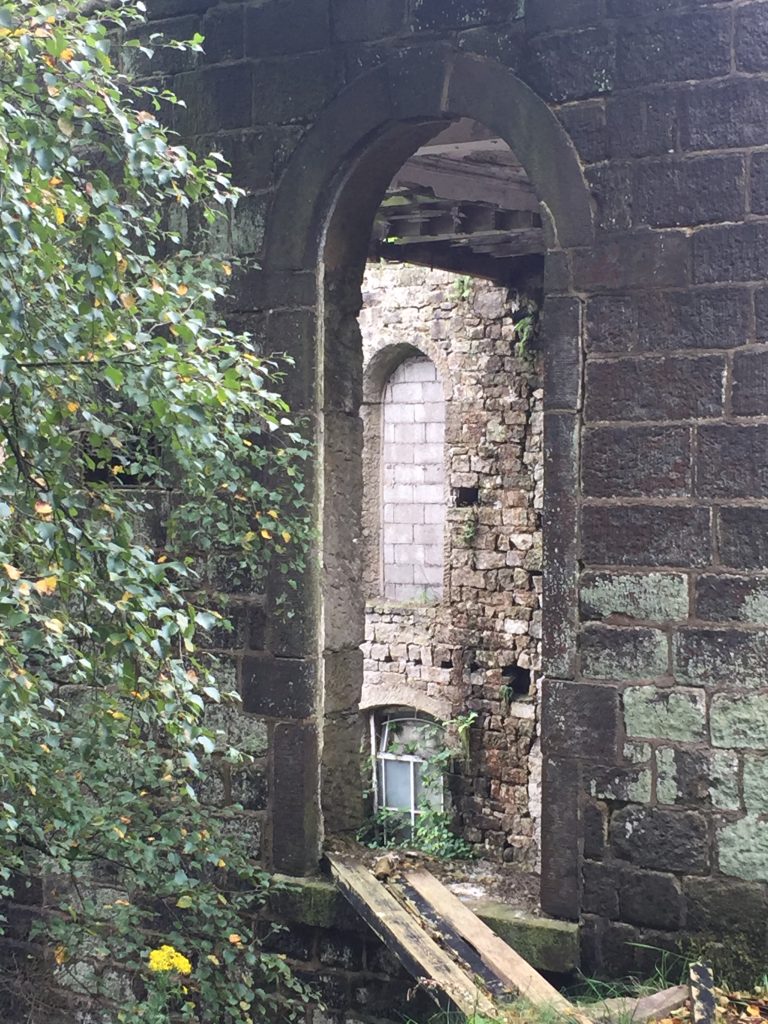
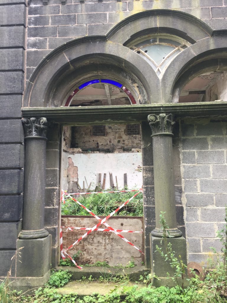
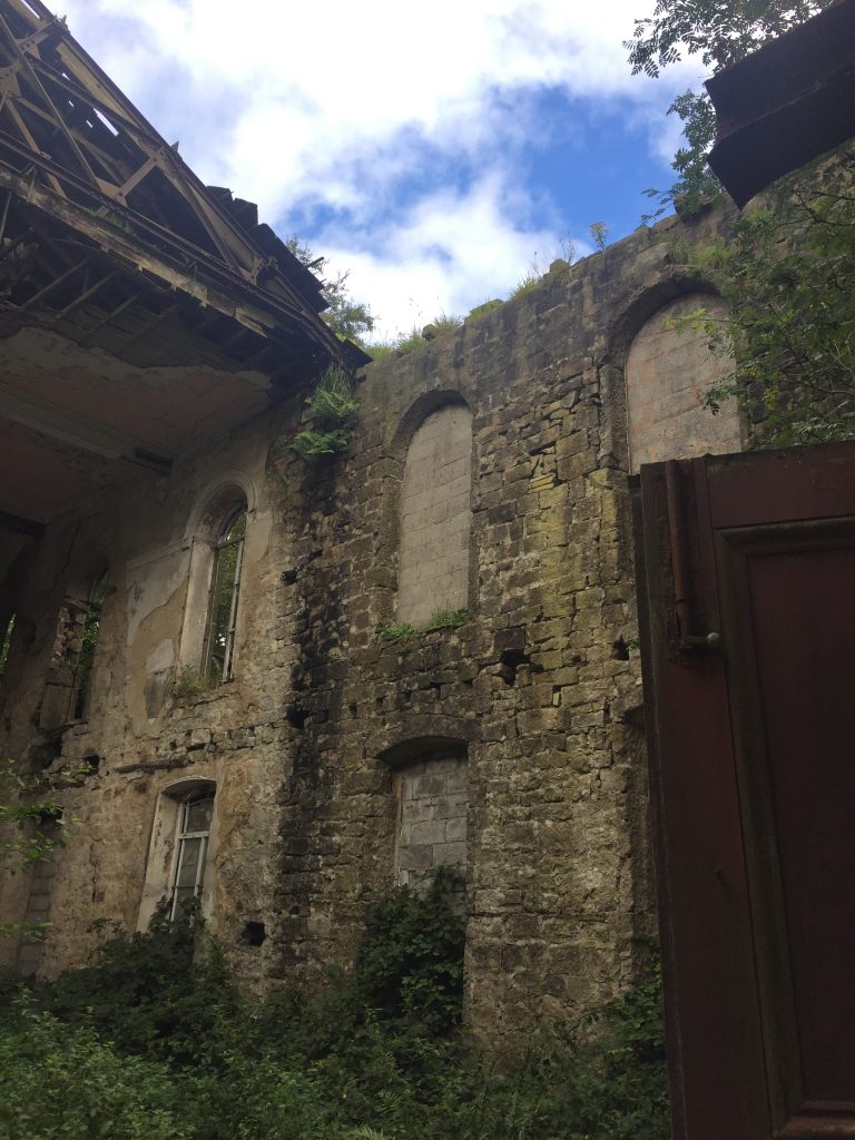
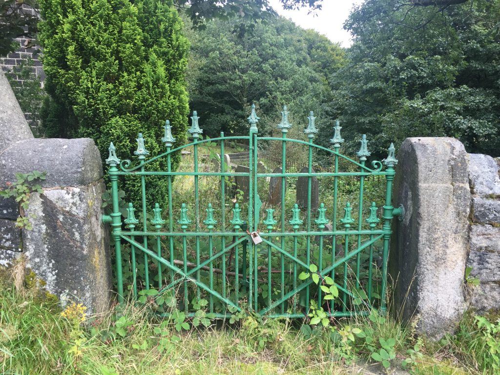
So I spent the next half hour or so scrambling round the building which once held the church and the adjacent Sunday School. I’d found an old film made in 1971 about a year at this church showing people arriving by taxi (yes, the road is REALLY steep) , singing in the ladies’ choir, the children’s choir, the Sunday school prize giving, tea parties, the annual coach trip (in this case to Cliffe Castle, Keighley which, as it happens, was my last day out before lockdown). The roof of the chapel fell in years ago, after the church had been declared unsafe because of dry rot. With a bit of prodding the wrought iron gate opened (it was just held closed by a large stone) and I was able to see inside the chapel since the front wall has gone.
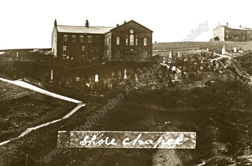
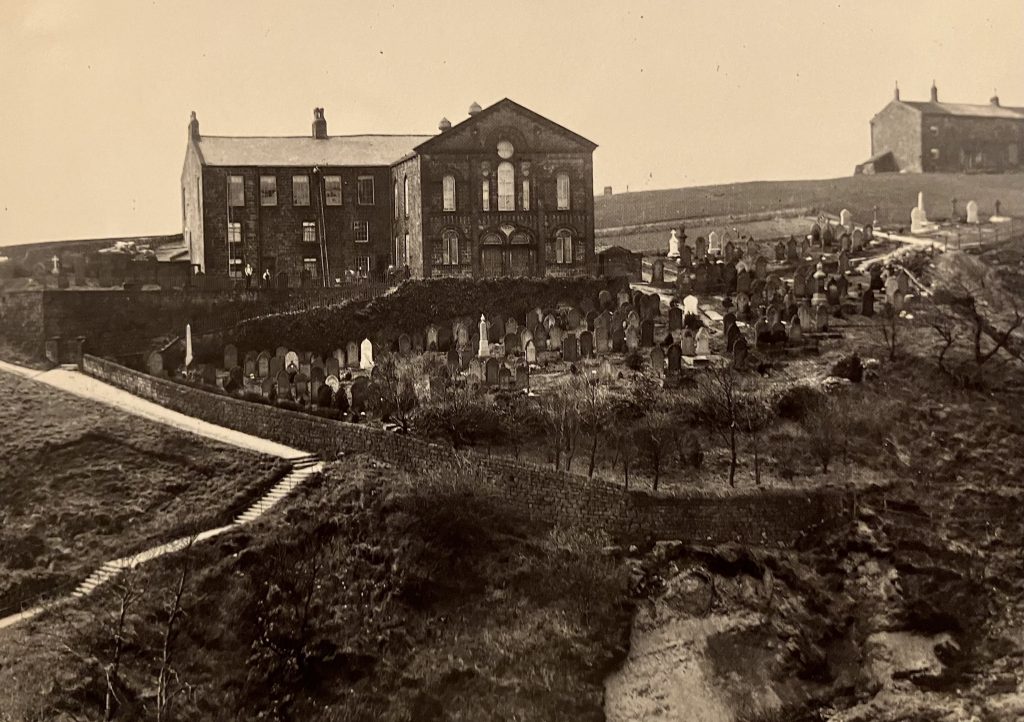
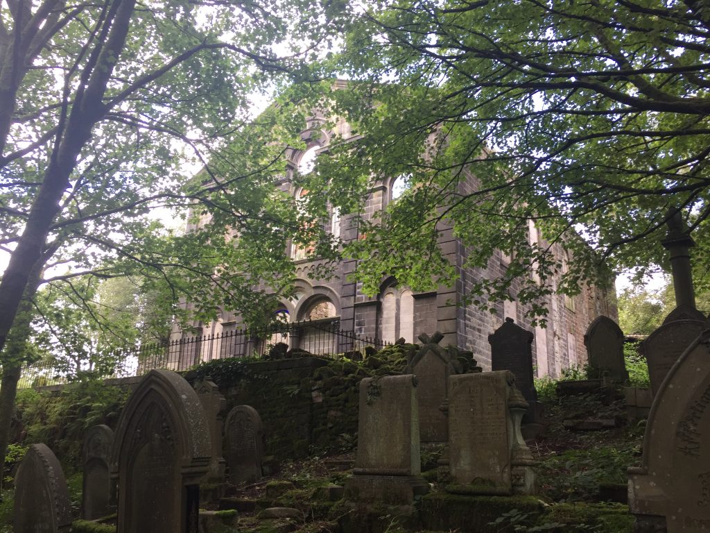
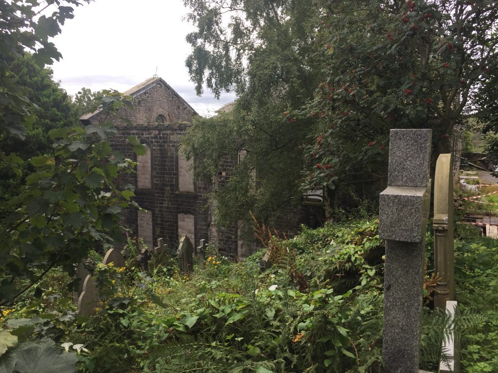
Someone had made a bonfire of their rubbish in what had once been the nave. The coving around the light fittings could clearly be seen and the wooden planks strewn over the floor had once been pews. The whole site is now overgrown with trees and so taking photos was difficult because so much of the building was obscured by the trees and also where I could see the building everything was in dark shade.
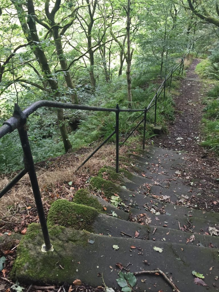
I’d read about a flight of stairs at the West side of the chapel. The church is perched right on the edge of the cliff and so the extensive graveyard appears to be falling down the hillside. 122 steps with an iron rail still present in places goes down to the Wattenstall River and, this being a Baptist church, people went down the steps to be immersed in the River as part of their baptism ceremony. Then they would climb back up the stairs for the service in the church. The General baptist Repository and Missionary observer of 1865 records that on June 10th Mr Gill baptised 41 people, 21 men, 20 women, the youngest candidate being 15, the oldest being 77. Some baptisms took place on Christmas Day when the ice on the stream had to be broken. It wasn’t until 1871 that the Baptistry was installed inside the church!
The church was founded in 1777 (just 2 years before the Piece Hall opened) by 7 people inspired by Dan Taylor from Birchcliffe Chapel, Hebden Bridge – which now serves as the area’s archive repository. (A couple of days later I was taking a walk along the steep Wadsworth Lane high above Birchcliffe when I noticed this plaque on a house):
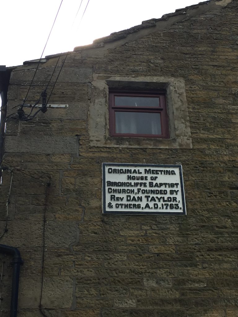
It transpired that it was one of my ancestors, Daniel Eastwood, who was responsible for the erection of the plaque. See : http://blog.hmcreativelady.com/?s=eastwood
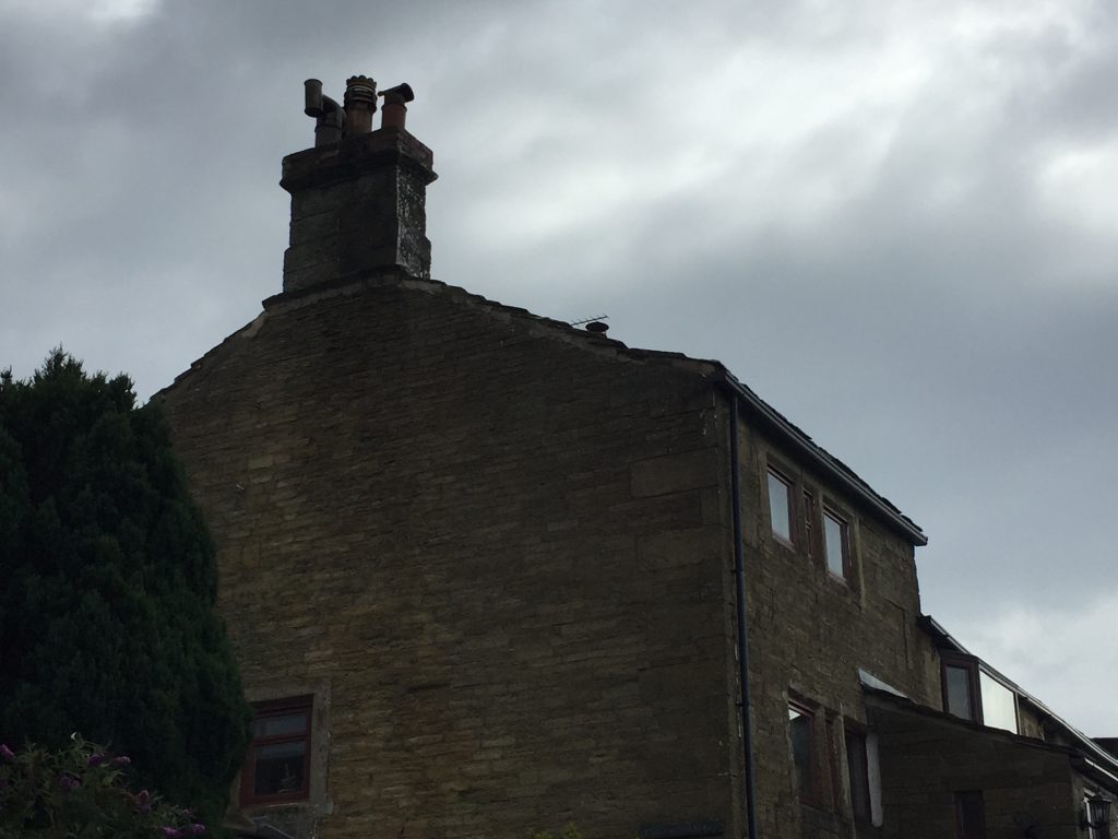
In 1833 and again in 1871 the church was considerably enlarged reflecting the growth of the cotton industry in Cornholme. When the centenary was celebrated in 1877 the church had 265 members but by 1970 dry rot had set in and all services were being conducted in the adjacent Sunday School. In 1985 a decision was made by the church members that it should be demolished. However, that didn’t happen and 35 years later, here I was in the ruins. At length I found a newish looking sign posted on a door:
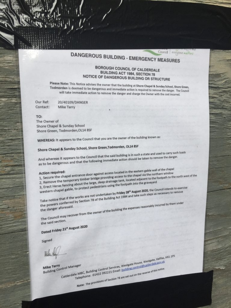
I’m so pleased that I visited when I did. Who knows when the council will take it upon themselves to demolish the place. From the notice it could be any day starting yesterday!
The video of a year in the church, 1971:
https://www.youtube.com/watch?v=0ystOsI6Kss&list=WL&index=68 Watching this made me think I was back at Affetside Sunday school, singing in the choir and I still have the books I was given at prize givings there. This is filmed at the Sunday school after the church had to be closed for good as being unsafe. My absolute double is in the children’s choir. Can you spot her?
Then watch a bit of this – minute 25-35 shows the church and seeing this was the catalyst that made me want to go and explore the church: https://www.youtube.com/watch?v=MeOaBq2jlmg
I also found a booklet at Todmorden visitors’ centre called the Story of Shore General Baptist Chapel’ by Les Marshall and George Lambert published in 2016 which includes this hymn written by Rev. J. Maden, minister of Shore 1868-1875
‘How rugged are thy paths, O Shore!
And yet we climb them more and more
Up to the sacred hill.
Thousands have gained that rocky height,
And gazed around them with delight
But we are pilgrims still.”
Why is Shore called Shore?. A couple of days later I found the answer in a booklet called ‘The Story of Shore General Baptist Chapel’ which I purchased at Tod visitors’ centre. Shore is an old English name for river bank or precipitous slope! The booklet tells of the anger and problems arising from a demolition order made in 1985 that has never been carried out.
Update – August 2023
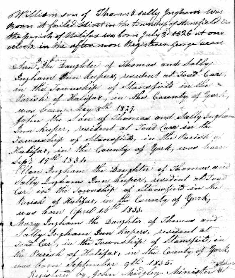
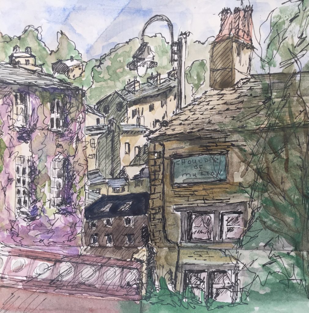
Almost 3 years after my one and only trip to Shore Chapel I was sitting in my new living room late one evening just getting back into some family research after the upheaval of moving house when suddenly something on the screen cause me to shout out ‘Yes!’ in utter amazement. I have been going through the list of my over 3800 Nutton family relatives on Ancestry.com in a systematic way – alphabetically – and I’d arrived at Ellen Ingham, 1834-1897. Up popped a few ‘hints’ and there it was. A handwritten entry by the West Yorkshire non conformist register itemising the dates of birth of 5 Ingram children and the registrar was John Midgley, minister of Shore. So ‘yes’, one of my ancestral families attended Shore Chapel. I just knew it! From sites.rootsweb.com I found that ‘Church membership grew during the time of the church’s longest serving minister, Rev. J. Midgley, who was pastor from 1819 to 1844. This was at a time when the population of Todmorden increased rapidly. He started a Sunday School as soon as he commenced his ministry, and after 1825 this became an annual event. The minute books reveal that the children attending the Sunday School were separated during the church service, the boys attended chapel in the mornings and the girls in the afternoons. In 1864 it was recorded that it was dangerous to teach the girls around the stove because of the crinolines they wore.’ 1826 was the first recording of the Ingham family’s children so that was just a year after the Sunday School opened. (The extract is a little ambiguous). The first Ingham in the record reads ‘William, son of Thomas and Sally Ingham was born at —- Hirst in the township of Stansfield in the parish of Halifax was born July 3, 1826 at one o’clock in the afternoon. Registrar George Dean, but by the time at Ann was registered on May 8, 1929 Thomas and Sally were innkeepers, resident at Toad Carr. From previous research I had discovered that for over 75 years the Ingham family, first Thomas Ingham, then his son William and finally his grand daughter Ann ran the pub: In the Todmorden Almanac I found that ’Mr Thos. Ingham commenced selling drink at the Shoulder of Mutton Inn, Toad Carr, Dec 12, 1826. For my account of visiting the Shoulder of Mutton go to: http://blog.hmcreativelady.com/?s=jack%27s+place
It’s been a while since I last posted. I could blame many things: the inclement weather, lethargy, started working on a book, getting back into some more serious piano practice, the concern about the fires back in Santa Cruz, the realisation that Covid 19 is here to stay for a while, etc., etc.
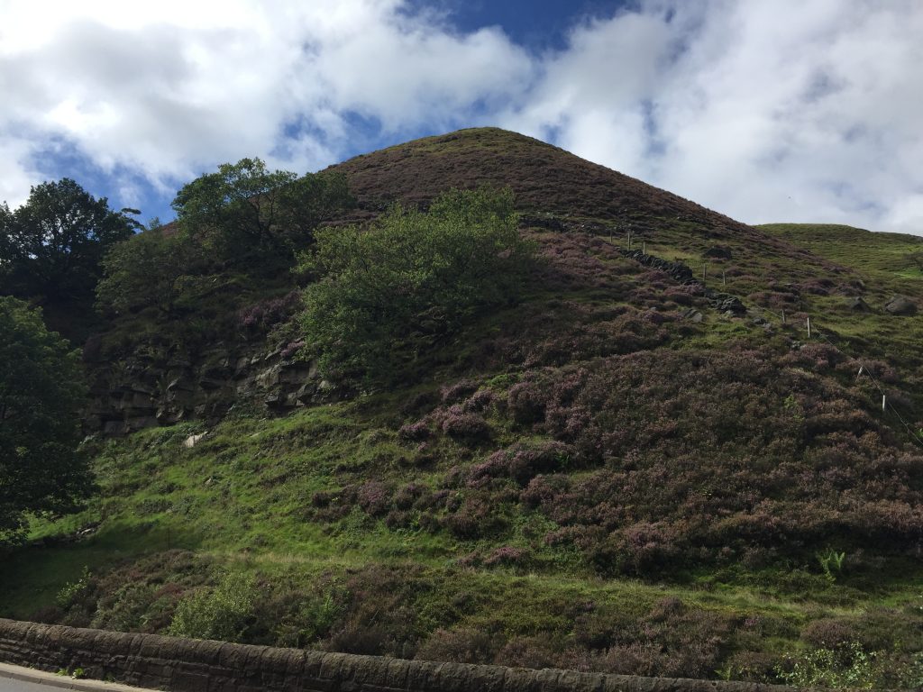
But last week I just happened to watch a YouTube video of a guy hiking in the Cliviger Gorge, the valley the connects Todmorden to Burnley. I’d watched a couple of his homemade videos before, mostly around the Calder Valley, so this was a new area for me, and it showed a ruined chapel at Shore, near Cornholme. The roof is off, walls are missing, it’s perched on the edge of a cliff, and it’s difficult to get to. What more could I ask? The perfect place for exploration.
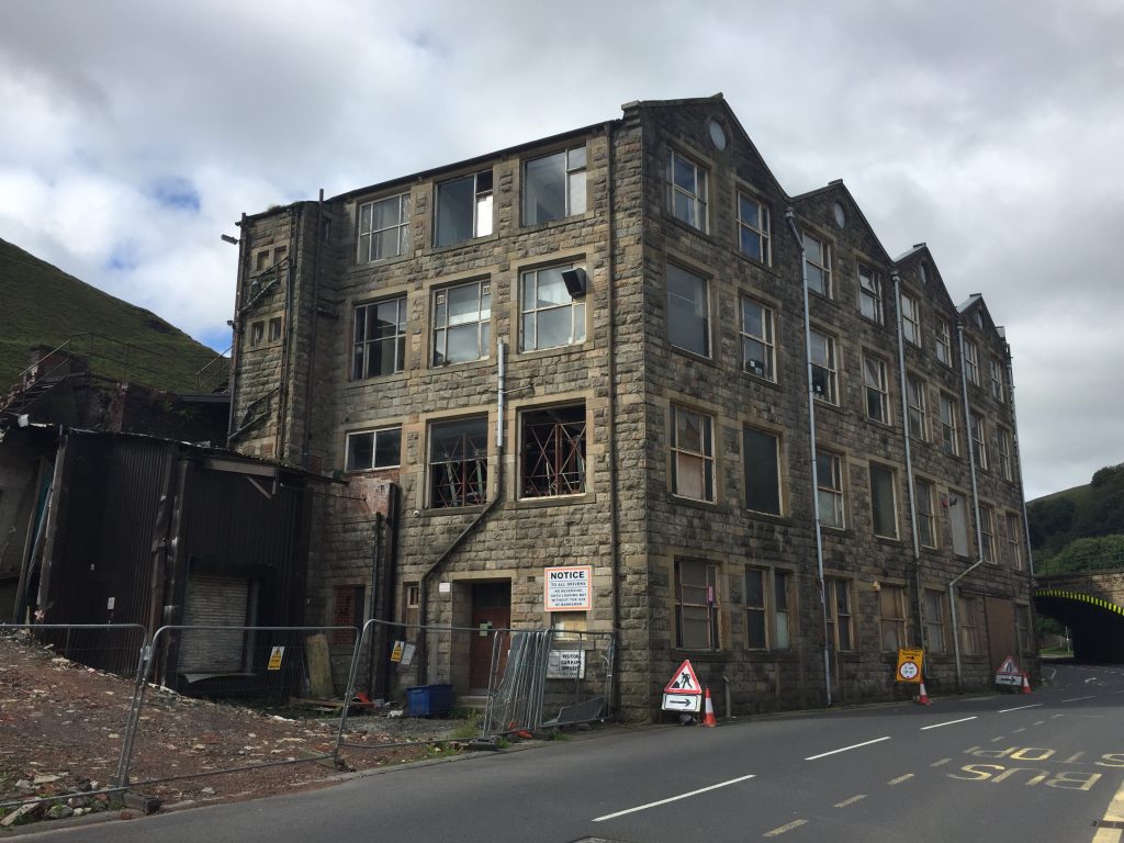
So my first step into the valley came last week when I took the Burnley bus as far as Cornholme and then just followed the road back down into Todmorden. Though I’d travelled along this 8 mile valley by train and bus before I’d never walked through it. A few derelict mills are wedged in the valley bottom which, like the Calder Valley forms a very narrow channel for a road, a railway line, a river, and a few small communities.
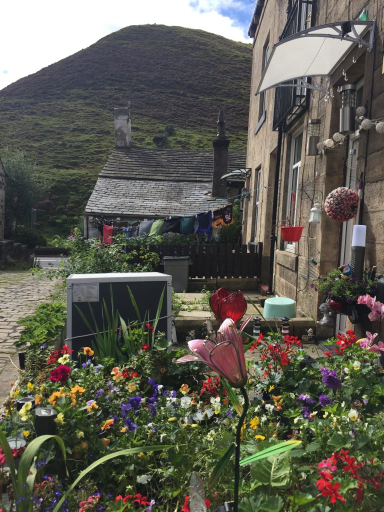
In fact the lower end of the valley is narrower than the Calder valley in Hebden Bridge and some of the terraces of houses are only around 4 houses long on either side of the main road. Unlike Hebden Bridge few houses are perched on the valley sides because the land here is notoriously unstable. The valley sides appear to be full of hummocks, caused by landslides over the millenia. A little coal mining was done, some iron smelting and then the textile mills took over during the industrial revolution. I passed a lane heading steeply upwards signposted to Shore but I wanted to do more research before heading up to the ruined chapel.
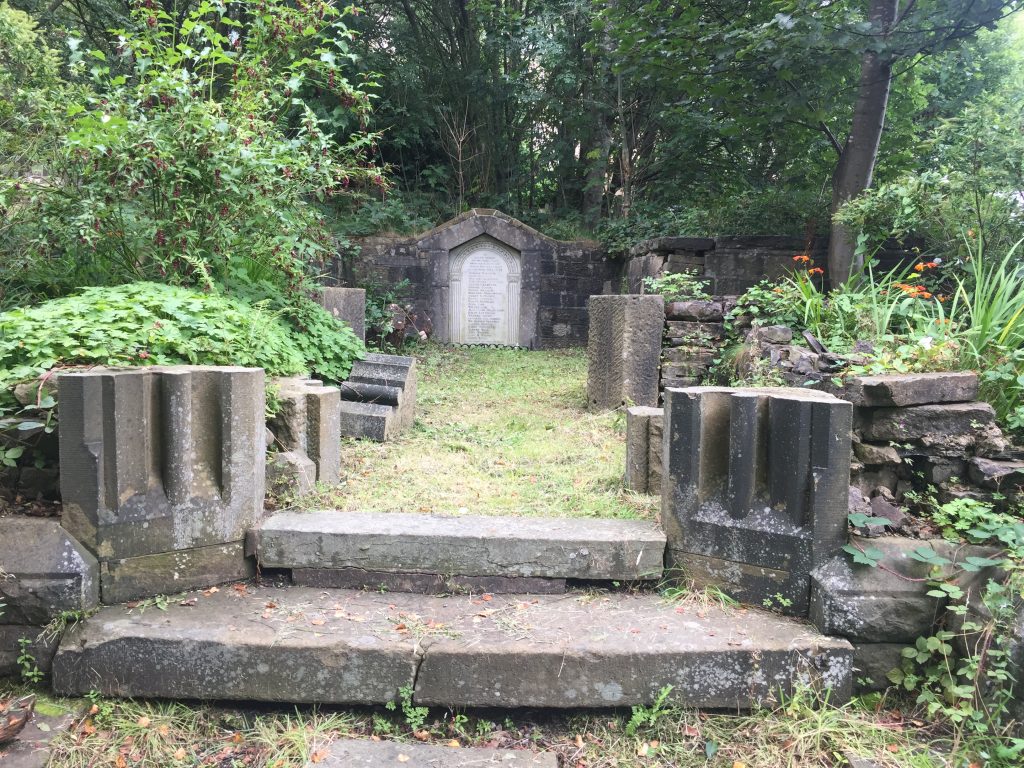
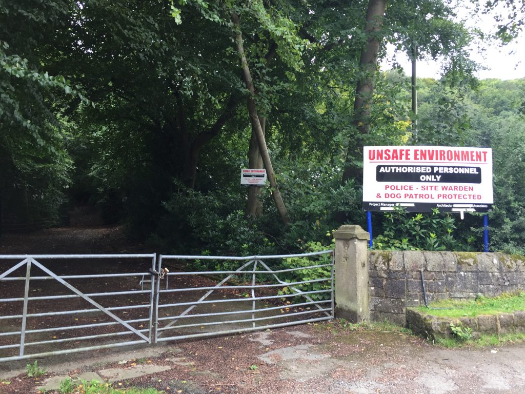
Arriving back on the outskirts of Tod I came to an imposing gateway leading into a densely wooded area. Big signs saying police cameras, dog patrol, hazardous to your health, razor wire made me inquisitive and on researching when I got home I found that the drive once led to Todmorden’s most famous hotel which was the victim of arson and now lies derelict.
I passed the Hare and Hounds and Jack’s Place, 2 pubs that my ancestors had kept years ago, then past Centre Vale Park, one of the few flat areas of land in the area. The River Calder rises in the hills above the Cliviger Gorge, part of it heading into Yorkshire and past into Lancashire. Bob Gaunt and Annie Harrison who I worked with on the aging Project at Manchester Uni are currently tracing the Yorkshire Calder from its source to the sea.
Built in a Tudor fashion with a porch, mullions and leaded lights, the building still incorporates some of its earlier materials, in particular the numerous stained-glass windows in the Garden Room and the large rear window of the main stairwell. More info and photo of the house in its heyday:
https://sites.rootsweb.com/~todmordenandwalsden/Scaitcliffe1.htm

Recent Comments